
How to Get Around Boston Like a Local
Walking, Transit, and Time-Saving Hacks for Exploring America's Walking City
Experience Boston’s organized chaos: streets built for pedestrians, not cars. The historic center, packed into a compact three-mile radius, makes driving more of a hassle than a help. In the time it takes to find parking, you could already walk from Faneuil Hall to the Seaport.
If you want to get around like a local, ditch the car and stick to your own two feet or the 'T'. This is one of the rare American cities where a connected network of trains, buses, and subways makes it easy to get around.
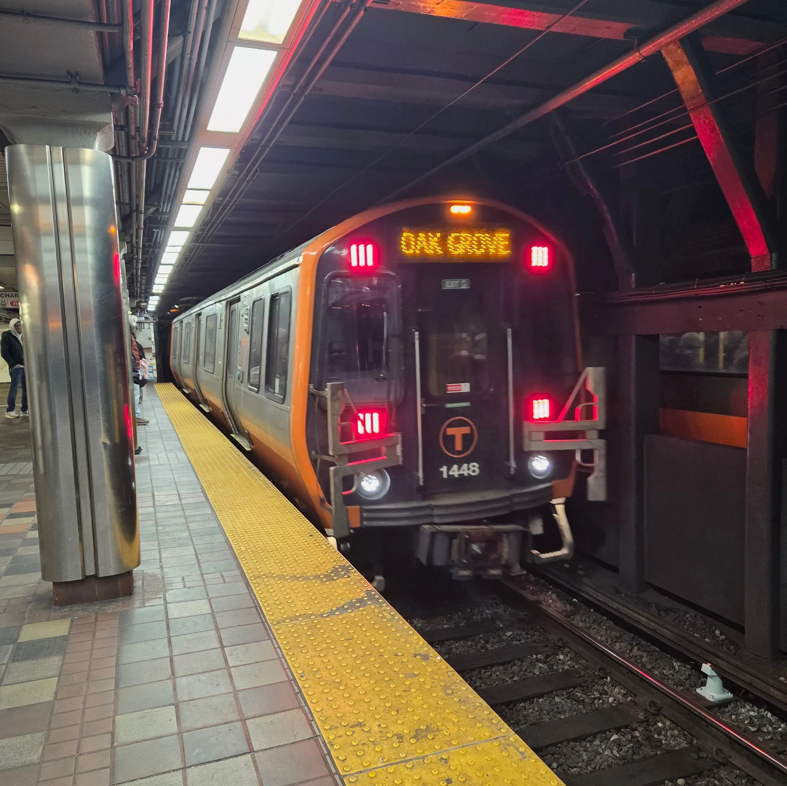
The Massachusetts Bay Transportation Authority (MBTA), known as “The T,” is the city’s lifeblood. From the historic Green Line trolleys to the fast Orange Line, it connects neighborhoods in minutes. It’s designed to be accessible, with elevator access at most stations and ramps on all buses, making it easy for travelers of all ages and abilities.
Quick Wins: Your First 24 Hours
To help you hit the ground running, here are a few local essentials to keep in mind before you head out:
Set up contactless payment (Apple Pay, Google Pay, or tap-to-pay credit card) — works on all trains and buses.
Download the MBTA app for real-time train updates (or ProximiT if you want the cleaner interface)
Know the magic words: "Inbound" = toward downtown. "Outbound" = away from it. This means if you ride through downtown, your train will switch from Inbound to Outbound while you’re on it!
Bring your most comfortable walking shoes; those 17th-century brick sidewalks are enchanting, but a little uneven underfoot. Even when going out at night, you won’t see many locals in high heels.
The Joy of a Car-Free Visit
One of the best things about Boston is how well it accommodates pedestrians. The city’s compact layout means the most scenic route is often also the fastest.
The Ease of Transit: Between our one-way streets and the legendary downtown bustle, you’ll often find that public transit is actually the faster way to reach your destination. For destinations a bit further out, like the Harvard Yard in Cambridge, the subway is often much quicker than navigating city traffic.
Join the community effort: Getting around on foot or by “T” helps shrink your carbon footprint in one of America’s greenest cities.
A Win for Your Budget: Opting for public transit means you skip the premium fees of downtown garages and the confusion of our historic one-way streets. Downtown parking typically ranges from $30 to $50 per day.
Stick to the MBTA and keep that extra room in your budget for what really matters. Think of the money you save on parking as your “local flavor” fund. It’s much more rewarding to try a multi-course North End dinner, a sophisticated Back Bay rooftop meal, or brunch in the South End or Charlestown than feed a parking meter!
If you'd rather spend your time taking in the sights than checking a map, joining one of our guided walking tours is a fantastic way to discover these hidden gems while learning the stories that made Boston famous.
Walking Boston: The Freedom Trail & Beyond
Boston was built before cars, before wide boulevards, before city planning as we know it. Early settlers designed streets to connect homes, markets, and workplaces. When you walk in Boston, you’re literally following paths first laid in the 1600s.
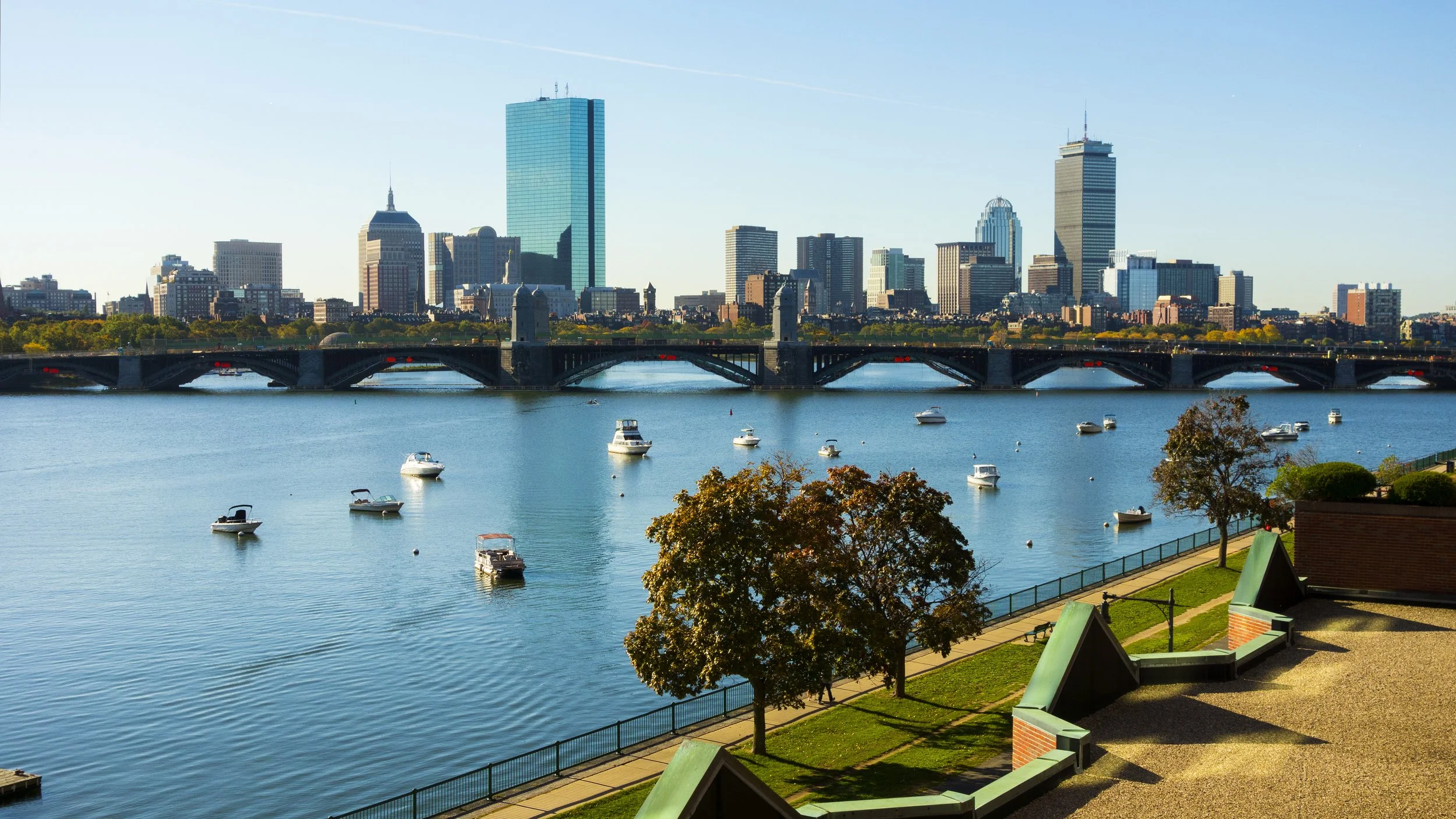
In under an hour, you can move from the glass-and-steel innovation of the Seaport to the gas-lit colonial allure of Beacon Hill.
The Freedom Trail: Your Greatest Hits Tour
This 2.5-mile walking route connects 16 Revolutionary War sites, from Boston Common to the Bunker Hill Monument. Just follow the red brick (or painted red) line embedded in the sidewalk.
Don't-miss stops:
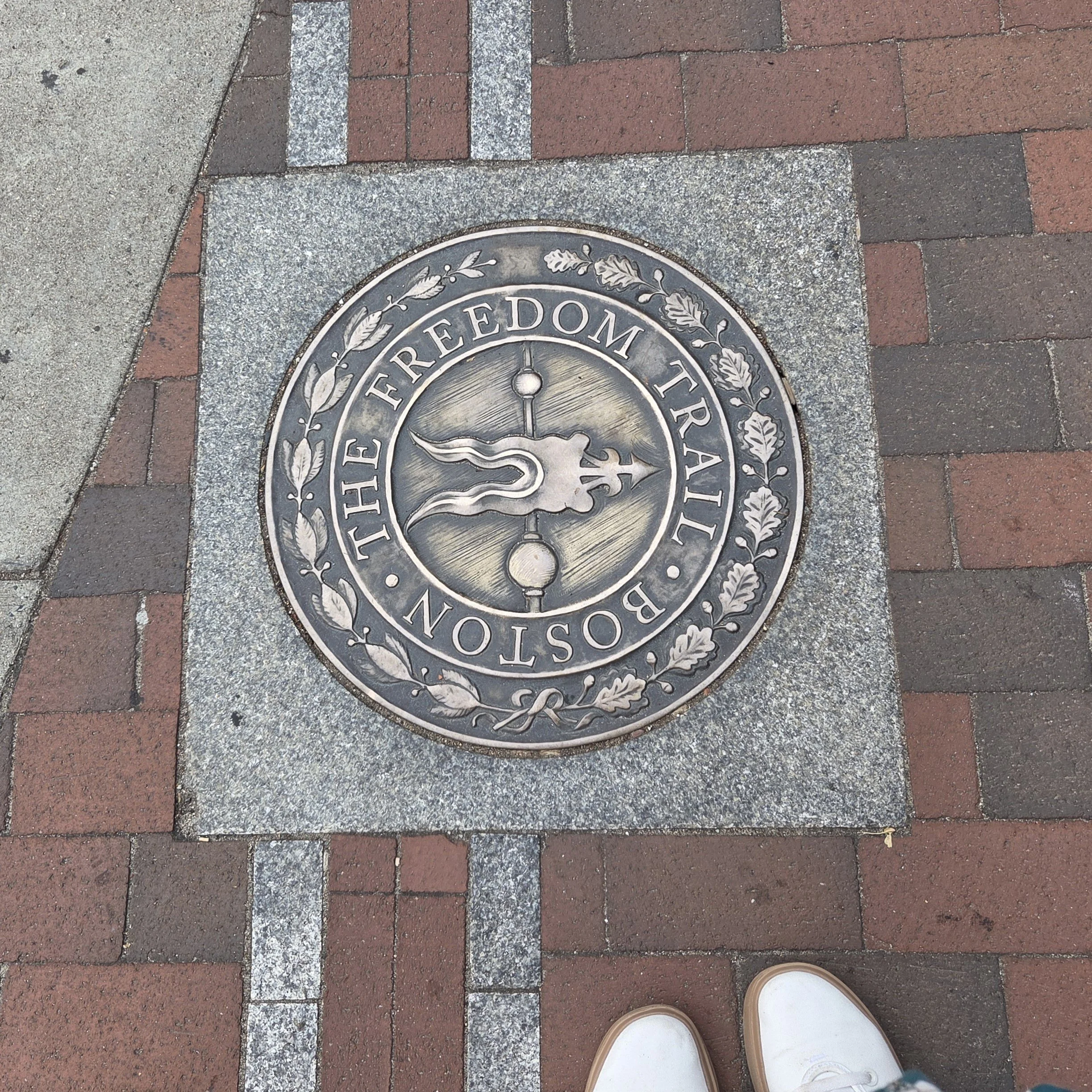
Freedom Trail Plaque
Boston Common — America's oldest public park (1634)
Faneuil Hall — Revolutionary meeting spot, now surrounded by food vendors
Old North Church — Where Paul Revere's famous lanterns hung
USS Constitution — The world's oldest commissioned warship still afloat
Accessibility Note: Sidewalks vary from neighborhood to neighborhood. Cobblestones and brick paths can be uneven and slippery when wet, especially where tree roots have shifted the stones.
Experience the history of the trail with a private guide. View our Freedom Trail Tour here.
Neighborhood Vibes at a Glance
Beacon Hill — Steep, narrow streets with Federal-style row houses and gas lamps. Acorn Street is Boston's most Instagrammed block (and yes, it's worth the hype). Fair warning: it's hilly. Stick to Charles Street for gentler terrain and great shops.
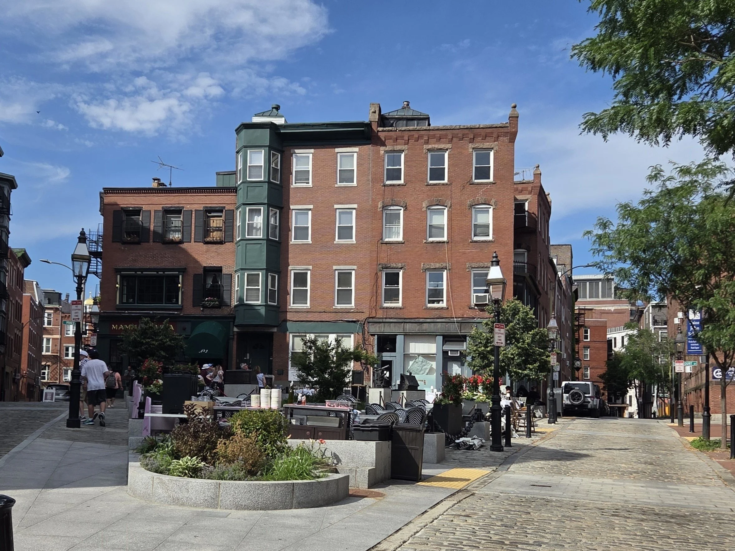
North End — Boston’s Little Italy. Narrow alleyways, cash-only cafés, and the constant smell of fresh cannoli. Locals love Sunday dinner here. Pro tip: Try cannoli from Mike’s Pastry or Modern Pastry and pick your favorite! (join the local debate).
Back Bay — Wide, Parisian-inspired boulevards like Commonwealth Avenue. Flat, easy to walk, and lined with brownstones. Newbury Street is your shopping destination (high-end boutiques mixed with affordable chains).

Seaport District — The new kid on the block; in the early 2010s it was still mostly parking lots! Glass towers, waterfront beer gardens, and the Harbor walk. Completely modern, totally flat, and perfect for sunset walks. This neighborhood is easily accessible with the Silver Line.
Footwear Matters: What to Wear When Walking in Boston
Those brick sidewalks and cobblestone streets? Beautiful, historic, and tough on the wrong shoes. Pack comfy shoes and save heels for dinner out.
Seasonal reality checks:
Winter: Black ice on brick paths is real. Tread carefully (and wear something with treads)
Summer: Humidity makes every walk feel 30% longer. Carry water.
Year-round: New England weather is unpredictable. A light rain jacket is your friend.
The T: Your MBTA Survival Guide
After discussing the benefits of walking, here's how to master Boston’s subway, bus system, and CharlieCard.
In 1897, Boston opened North America’s first subway, ending the era of horse-drawn traffic jams. Today, the T is a color-coded network that connects the metro area in a reliable, affordable, and faster way than sitting in traffic.
How to Pay
There’s no need to wait in line at a ticket machine or worry about purchasing a physical CharlieCard. You can simply tap your smartphone (with Apple Pay or Google Pay) or any contactless credit card directly at the turnstile or bus sensor. It’s a seamless way to move through the city, letting you focus on the sights rather than the logistics.
| Option | Cost | Best For |
|---|---|---|
| Single Subway Ride | $2.40 | One-time trips |
| Bus (with transfer) | $1.70 | Short distances |
| Contactless Payment | $2.40 | Just tap your phone or card! |
| 7-Day LinkPass / CharlieCard | $22.50 |
BEST VALUE for tourists! Reusable plastic card for longer stays. Pick one up in major stations at a ticket machine. |
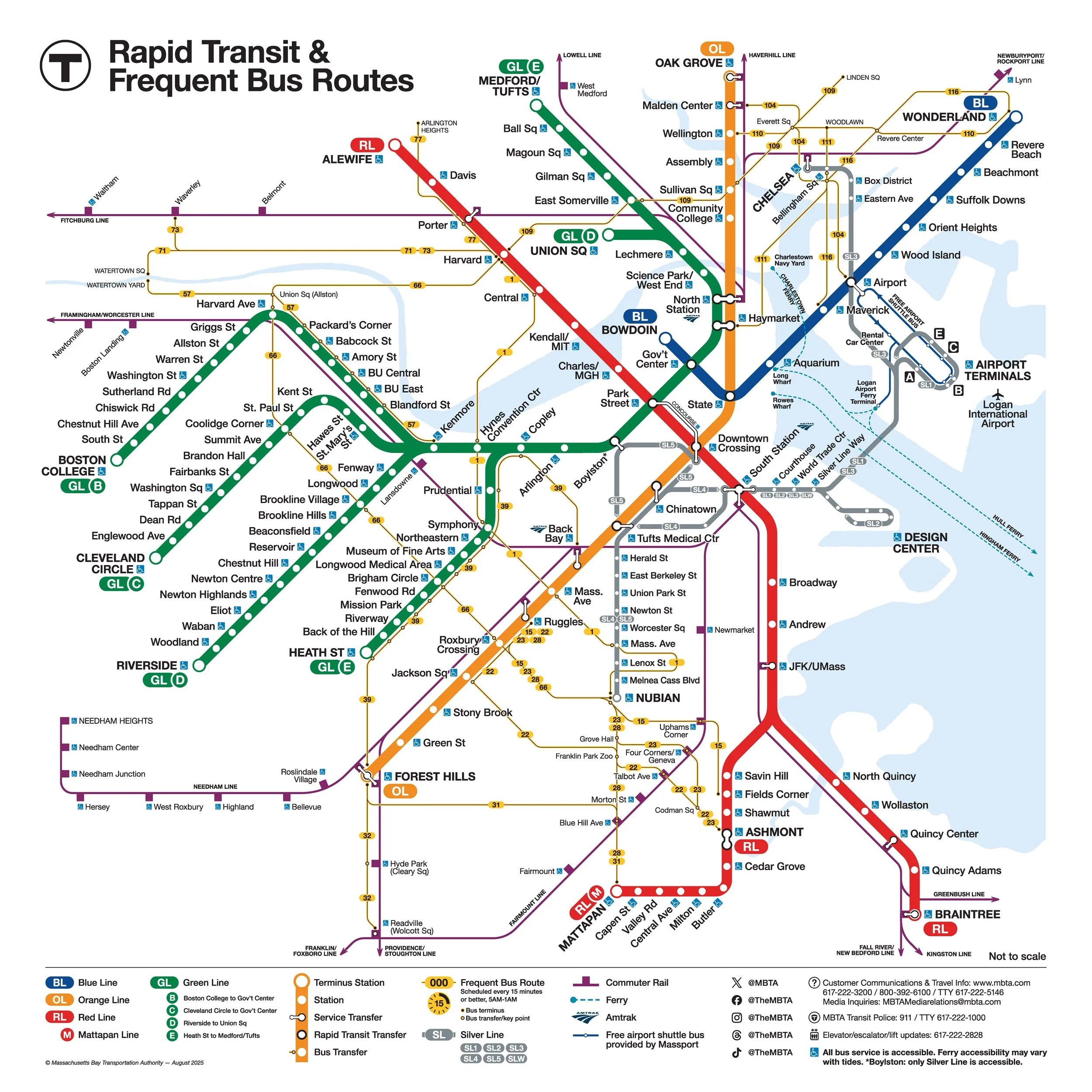
Boston’s Color-Coded Subway Lines
Boston’s subway is color-coded, making the system surprisingly easy to master once you know the basics. Each line has its own personality. Here's what you need to know:
| The Line | Major Stops | Local Knowledge |
|---|---|---|
|
RED LINE The Academic Line |
|
Heading to Cape Cod? This line connects you to the ferries and buses at South Station.
|
|
GREEN LINE The Tourist Line |
|
Check the Letter: The branches split. For Fenway, take B, C, or D—avoid the E train!
|
|
ORANGE LINE The Fastest Line |
|
Simple and direct north-south route. No branches to worry about! |
|
BLUE LINE The Airport & Beach Line |
|
The quickest way to get from the waterfront to the airport terminals. |
|
SILVER LINE The Airport Express |
|
Travel Hack: The SL1 is free from Logan Airport to downtown!
|
Why Are the Train Lines the Colors They Are?
Red Line: Named for Harvard University’s crimson, as Harvard Square was the northern end stop in 1965. The red also fits Cambridge’s brick and academic character. MIT also happens to have red as a school color too!
Blue Line: Chosen for water. The route runs under Boston Harbor and out to Revere Beach, reflecting the area’s coastal identity.
Downtown Crossing Orange Line train
Orange Line: Named for the old Orange Street corridor, now Washington Street. Yellow was originally planned, but orange replaced it for better readability.
Green Line: Essentially assigned at random. Though many link it to the Emerald Necklace parks, the MBTA disputes that origin.
Silver Line: Introduced in the early 2000s as airport-serving Bus Rapid Transit to Logan International Airport. “Silver” was meant to suggest speed and modernity, though riders still debate whether it earns that distinction.
Getting from Logan Airport to Downtown
One of the best things about Boston is that Logan Airport is remarkably close to downtown, and you can actually see the city skyline right from the runways! Getting to your destination is quick, affordable, and easy to do without a car. Here are your best options:
✅ Airport Tip: Plan your transfer before you land. With the Silver Line free from Logan and the Blue Line offering the fastest subway ride, most locals skip the car.
| Arrival Option | How it Works | Best For |
|---|---|---|
|
BLUE LINE Fastest & Cheapest ($2.40) |
Take the free Massport shuttle from your terminal to Airport Station, then hop on the Blue Line subway for a quick connection to downtown. |
✔ Budget travelers & downtown efficiency
|
|
SILVER LINE Free from Logan! |
A direct bus from the terminals to South Station and the Seaport. No transfer needed, and it’s completely free on the inbound trip. |
✔ Seaport hotels & Amtrak connections
|
|
WATER TAXI Most Scenic ($$) |
A memorable way to enter the city. Take a shuttle to the airport docks and enjoy sweeping, front-row views of the skyline as you cross the harbor. |
✔ Waterfront stays & celebrations
|
|
TAXI / RIDESHARE Most Convenient ($$$) |
Direct door-to-door service available at all terminals.
Local Tip: Avoid this during rush hour—in heavy traffic, the "T" is usually faster and cheaper!
|
✔ Heavy luggage & late-night arrivals
|
Local Hacks & Time-Savers
The best way to experience Boston is to move like a local: prioritize ease, embrace the fresh air, and know when the "T" might actually be the long way around. Here is the "insider" knowledge that will save you time and energy:
The 15-Minute Rule
Boston is so compact that if your destination is less than 15 minutes away on foot, just walk! Before you head underground to a T-stop, check your map for the walking time. By the time you descend into a station, wait for a train, and climb back up to street level, you could have already arrived. Plus, walking those extra blocks is the best way to stumble upon a hidden cafe or a historic plaque you might otherwise miss.
Beat the Crowds
To see Boston’s most popular spots at their most peaceful, try to visit locations like the North End or the Public Garden before 10:00 AM on weekdays. You’ll beat the midday rush and enjoy the morning light on the historic architecture, making for a much more relaxed stroll and beautiful photos.

Scenic #1 Bus view of Boston from Cambridge
Free Transfers (with a Charlie Card)
Your subway fare includes one free bus transfer within 2 hours. Use it strategically to explore neighborhoods not directly on the subway.
The Scenic Route to Cambridge
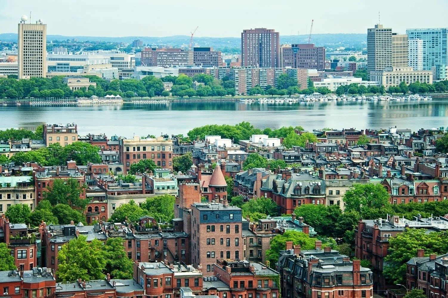
Skip the Red Line and take the #1 Bus along Massachusetts Avenue. You'll get skyline views, pass through multiple neighborhoods, and see the city like locals do.
After a Red Sox Game
Everyone floods the Kenmore Green Line station. Instead, walk 15 minutes to Massachusetts Avenue Station on the Orange Line. Same destination, zero crowds.
The Boston Pre-Trip Checklist
You’ve got the history, the routes, and the local know-how. Before you pack your bags for Boston, take a moment to run through this final checklist.
✅ Download Your Navigation Tools: Grab the MBTA app (or ProximiT) for real-time train arrivals. For walking routes and transit connections, Google Maps or Citymapper are excellent local favorites.
✅ Ready Your Tap-to-Pay: Ensure your mobile wallet (Apple Pay or Google Pay) or a contactless credit card is set up for easy, tap-and-go fare payment on all trains and buses.
✅ Pack supportive walking shoes (they will make your trip far more enjoyable)
✅ Skip the rental car unless you're going to take your day trips outside the city.
Or book one of our day trips and we’ll provide the transportation!
✅ Plan your airport transfer (Blue Line or Silver Line = easiest ways to downtown)
✅ Learn "inbound vs. outbound" (it'll make station signs way less confusing)
These essentials will help you move through the city more easily, save money, and avoid the most common visitor mistakes.
The Bottom Line: Embrace the Walk
Boston is a city that truly rewards those who slow down. Its compact size is its greatest superpower, offering a rare chance to experience a major American city where history isn't just tucked away in a museum, it’s built into the architecture and the daily rhythm of the streets.
By choosing to walk or take the "T," you’ll discover the hidden corners that car-bound travelers miss entirely. Many of our oldest neighborhoods, like the North End and Charlestown, were never designed for modern vehicles; their narrow pedestrian passages and quiet charms are best experienced at street level. Whether you’re following the Freedom Trail, hopping on the nation’s first subway, or stumbling upon a favorite bakery in the Back Bay, you aren't just getting from point A to point B; you're enjoying the journey to your next destination.
Arrive prepared, stay flexible, and step outside. Don't be afraid to ask for help if you lose your way. Once you've spent a day exploring, you’ll understand why we’re so proud of how walkable and welcoming this city truly is.