
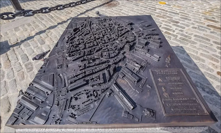
North End Self-Guided Tour
The North End is the city's oldest residential community, where Europeans have continuously lived since the area was settled in the 1630s. Although immigrants were not exclusively Italian, the neighborhood grew into Boston's "Little Italy," and has popular Italian restaurants lining the streets.
Take a stroll through the narrow streets of this charming neighborhood to feel transported centuries back. Get a taste of Italy with a delicious pasta meal, and finish on a sweet note with a treat from the local bakery.
Follow the path along the numbered stops on the map from start to finish. The guide below talks about the story behind each stop. You will visit famous locations such as the Old North Church and Copp's Hill Burying Ground, as well as quieter and lesser-known parts of the North End where tourists rarely venture.
Prefer a Guided Experience?
Join our North End Walking & Boat Revolutionary Group Tour! Walk the Freedom Trail, then ride a boat across Boston Harbor like Paul Revere!
3 hours • From $75 per adult
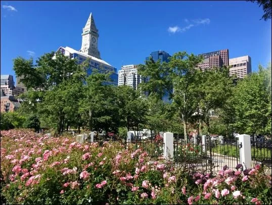
Book NowThe Rose Kennedy Greenway
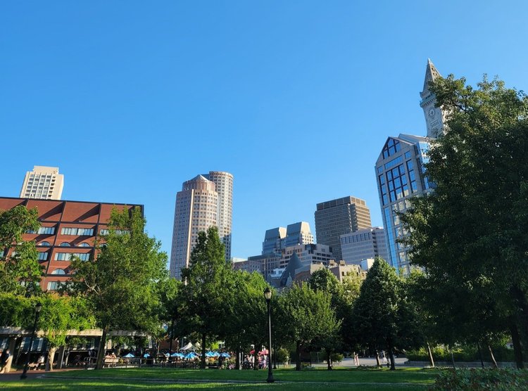
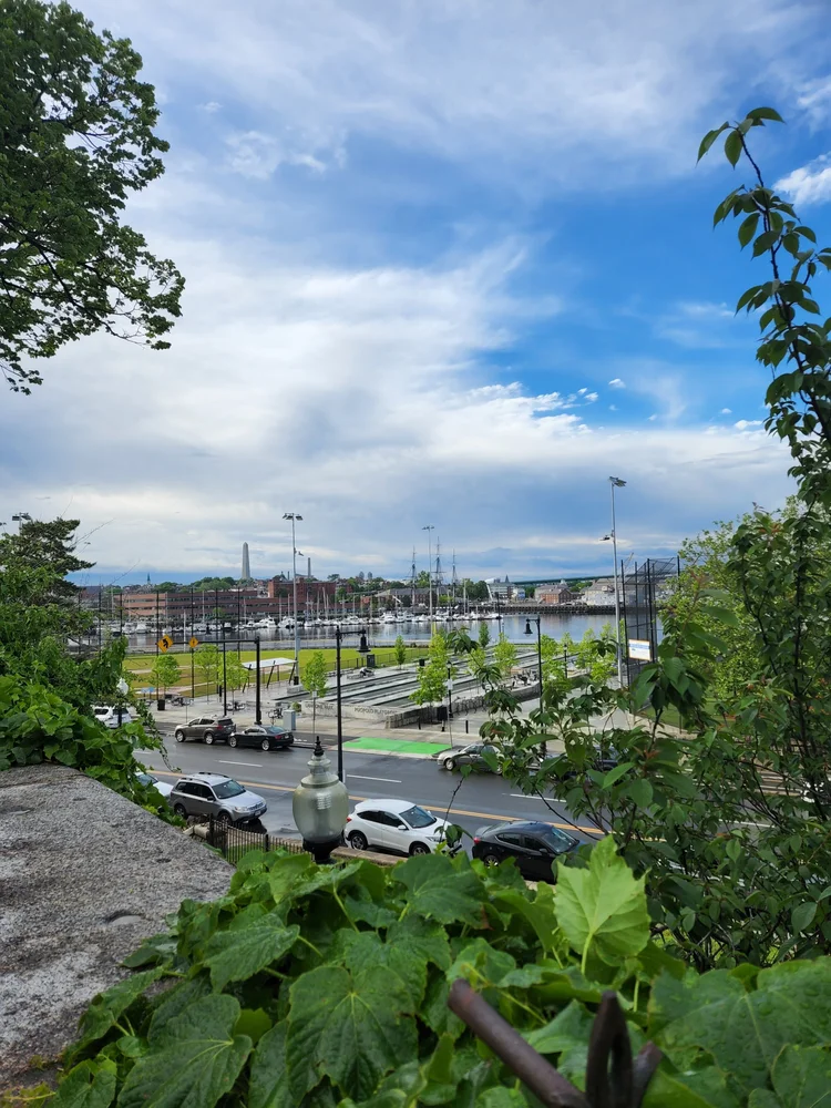
A modern park with breathtaking views of both the Boston skyline and the North End. The area was dominated by an elevated highway until a $22 billion project called the Big Dig moved the highway underground, creating the Rose Kennedy Greenway in 2006.
The Greenway marks the border to the North End. Before the Big Dig, crossing into the North End required passing under the unsightly bridge, effectively isolating the neighborhood from other communities nearby. Now, entering the North End is just a pleasant walk across the Greenway, opening up the neighborhood for tourists and city residents alike.
Head into the North End via Hanover Street. Turn right on Richmond St, then left on North Street. The Paul Revere House will be ahead on your left.
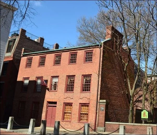
Paul Revere House
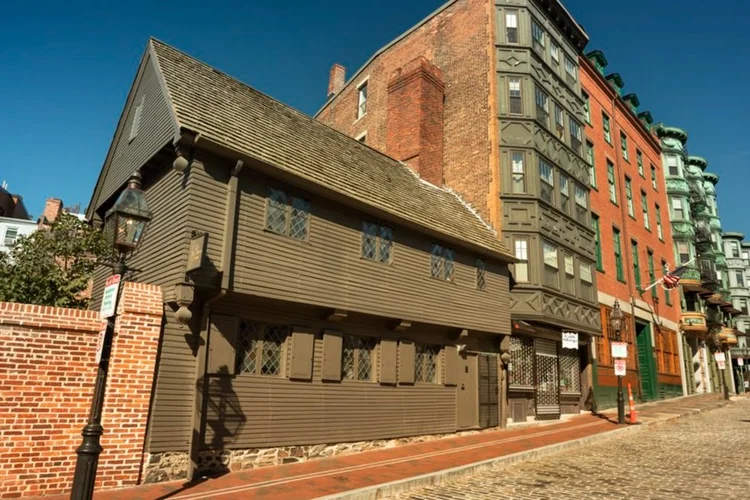
One of the oldest wooden houses in Boston, the Paul Revere House was built in 1680. Paul Revere purchased it in 1770 and lived here with his first wife Sara, five of their children, and his mother Deborah. Revere would eventually have 16 children, 11 of whom survived into adulthood.
The house reflects how homes were built in early Boston. Firewood was scarce and expensive on the peninsula, so houses were designed to keep heat in: low ceilings, small windows with shutters, and dark paint to absorb sunlight. Every house on North Square once looked like this, but a series of "Great Fires" destroyed most of the original wooden buildings.
Next door is the Pierce-Hichborn House, one of the oldest surviving brick houses in Boston, built in 1711.
We will learn more about Paul Revere and his famous midnight ride at a later stop on the tour.
Step back from the house. As you face the house, North Square is on your right - if you are walking this route during the summer, it may be filled with tables and chairs from the nearby restaurants! Not to worry, it is a public square and in the center, where the artwork is, you are allowed to walk at any time.
North Square
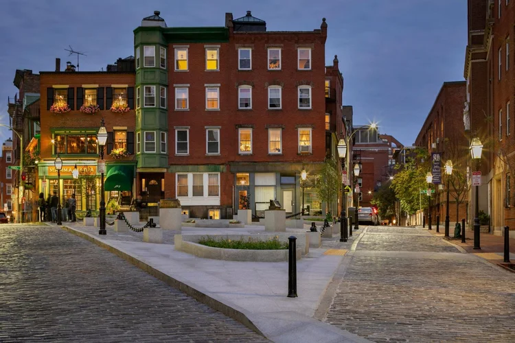
North Square is one of the oldest public squares in the United States, and has been continuously occupied since at least the 1630s. Formerly known as Clark Square, it has been a community gathering place and bustling market area for nearly four centuries. Paul Revere's house, the oldest wooden building in downtown Boston, faces the square.
The square is currently used for outdoor dining by multiple surrounding restaurants. Enjoy a lovely Italian meal with a stunning view of the North End skyline.
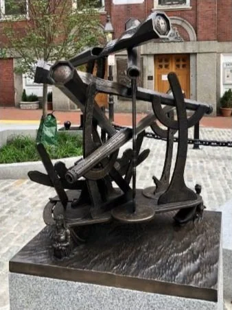
North Square Stories (4 Bronze Sculptures)
- North End Story Map - a relief of Boston in 2019. Can you find the Easter Eggs? (Hint: cannoli and garlic anyone?)
- North Square View - a relief of North Square as it was in 1798. Who is the boy with the spyglass?
- Fantastical Historical Nautical Monument - examine the markings and peek through the five spyglasses to get a glimpse of important figures from Boston's past.
- What We Brought With Us - a monument dedicated to the immigrants of the area.
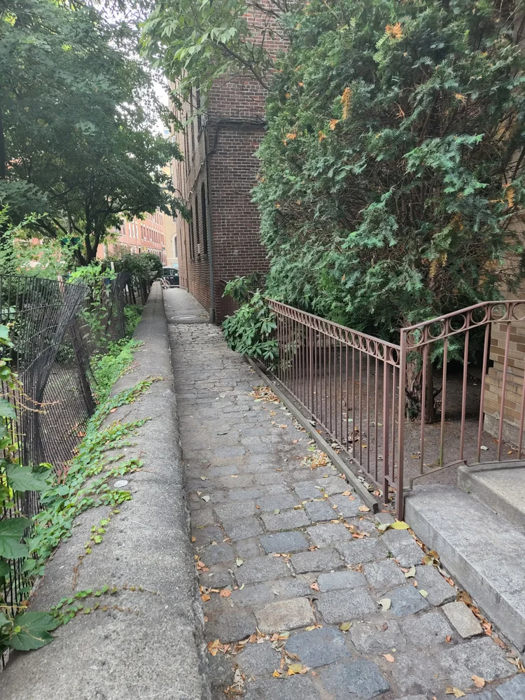
Exit North Square via the northern corner, between Mamma Maria and Ciao Roma Restaurants. Take Prince St to the left (past Artú Restaurant). Continue straight across Hanover St, past the garden and friary on your right, to the basketball court. Take a right and walk along the basketball court to the small parking lot at the other end. The building with the arched doorway on your left is our next stop.
Nazzaro Community Center
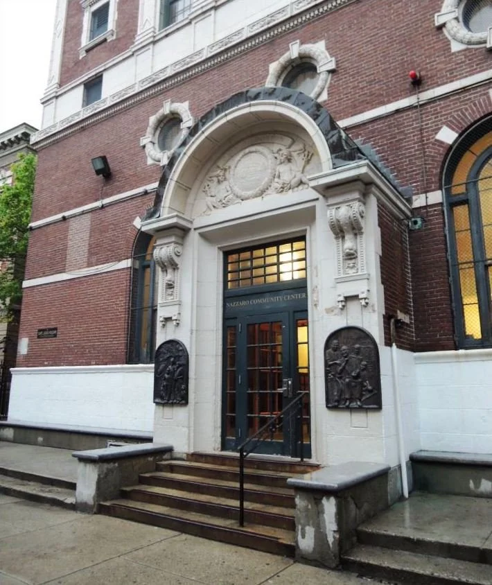
The Nazzaro Community Center Bath and Gymnasium (formerly known as the North Bennet Street Public or the North End Bath House) is one of the last remaining grand public bath houses, situated at the heart of Boston's oldest neighborhood.
Many of the early tenement houses in the North End didn't have baths or showers, forcing the residents to rely on a public bathhouse. The building evolved into a community center and a popular meeting place for after-school programs, seniors, community meetings, holiday parties and voting for over 100 years.
Take a right on North Bennet St and follow it back to Hanover St. Take a left on Hanover St and follow it to the Paul Revere Mall on your left, clearly marked by the statue of Paul Revere on his horse.
Paul Revere Statue & Mall
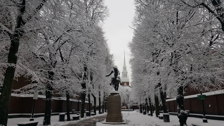
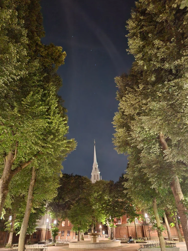
A statue commemorating Paul Revere's midnight ride stands at the entrance of the beautiful Paul Revere Mall. The Old North Church and the tree-lined park provide a perfect Revolutionary backdrop for photos during the day or night, summer or winter.
Don't miss the beauty of the rest of this small urban oasis. The Paul Revere Mall, inspired by the Paseo del Prado in Havana, was built to create a direct sightline between two historic landmarks: The Old North Church and St. Stephen's Church.
The crucifix-shaped park is lined with a nine-foot brick wall ornamented with plaques dedicated to famous historical figures associated with Paul Revere.
Take a brief pause on a bench in the shade next to the soothing fountain or take a few minutes to read the plaques around the park before proceeding.

Note the name on the fountain. Do you know who George Robert White was and why his name shows up on multiple statues and buildings around Boston?
Continue through the Paul Revere Mall to Unity St. Directly
across the street is the Old North Church Property. Just inside
on your left is the Clough House (also visible from Unity St).
Note: The Old North Church property is closed
overnight and some holidays; you can walk around by turning left
on Unity St, right on Tileston St, and then right on Salem St.
Clough House
The Clough House was built around 1715 by master bricklayer Ebenezer Clough as a home for himself and his family. It is a rare example of a surviving brick rowhouse, and is one of the oldest buildings in Boston.
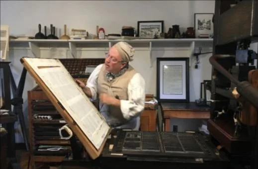
Today it is home to Printing Office of Edes & Gill where you can attend free live demonstrations of the colonial printing process. Pop into the Heritage Goods + Gifts gift shop for a souvenir made by family-owned companies with unique stories.
(Looking for more souvenirs? Check out the locally-owned gift shop Loft & Vine, located on Salem Street, just a 3 minute walk from the Old North Church.)
Continue up the stairs to the front of the Old North Church. If the property is closed, walk around to the front as per directions in the previous stop.
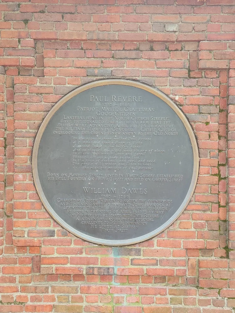
Old North Church
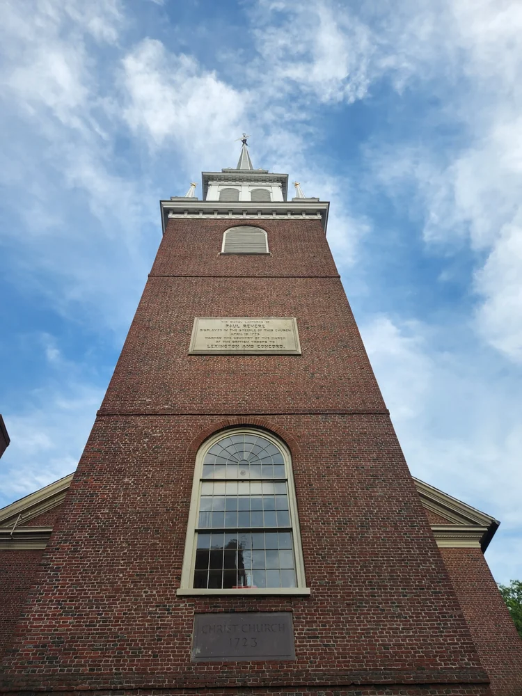
The steeple of this church is where the famous lanterns were hung by Paul Revere's compatriots before his midnight ride to warn people that the troops from Britain were approaching and the war was starting.
This ride was the origins of the famous poem that commemorated the phrase "one if by land, two if by sea." One lantern was to notify Charlestown that the British Army would march over the Boston Neck and the Great Bridge, while two lanterns would notify them that the troops were taking boats across the Charles River.
The lanterns were hung in the steeple windows for just under a minute to avoid alerting the occupying British troops, although this was enough time for the Charlestown Patriots to notice the signal.
Today, the church is an active Episcopal Church with congregations every Sunday.
Head up the street across from the Church - one of your two biggest uphills of the day! At the top of the hill there is a set of stairs on the right and a skinny, greyish wooden house on the left, across from the stairs. Look at the house for your next stop. Note that it is a local's home, not a museum, so please be polite and do not peer into the windows!
The Skinny House
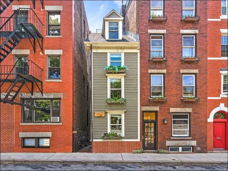
Before we begin, please note that this is an active home, not a museum, so please be polite and refrain from peering in the windows.
This narrow four-story house, squeezed between two generic townhouses, has the "uncontested distinction of being the narrowest house in Boston." Also known as the Spite House, the origins behind the unusual architecture are unclear. There are two common legends, and one story, that, while unexciting, is likely the closest to the truth.
A story of two brothers:
Two brothers inherited land from their deceased father. While one brother was away serving in the military during the American Civil War, the other built a large home, leaving the soldier only a shred of property that he felt certain was too tiny to build on. When the soldier returned, he found his inheritance depleted and built the narrow house to spite his brother by blocking the sunlight and ruining his view.
A tale of the typical Boston temper:
Legend has it that an unnamed builder erected it to shut off air and light from the home of a hostile neighbor with whom he had a dispute. Believed to have been built after 1874.
The likeliest true story:
This house was once part of a larger structure. The rest of the building was demolished for the larger brick houses that stand next to it today, and the Skinny House, for whatever reason, was left behind.
Head up the stairs into the cemetery. Take an immediate right and follow the path to the end, then turn left. Ahead of you are some steps down on the right. Follow those - you are allowed on the grass, don't worry!
Copp's Hill Burying Ground - Lower
The next three stops all take place in the Copp's Hill Burying Ground. Note that Copp's Hill closes at 4pm each day, so if you reach this point after that time, you will be unable to visit the next three stops, although we encourage you to still read about them!
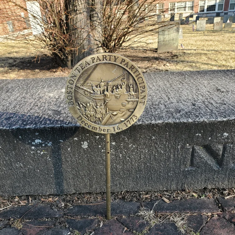
Copp's Hill was Boston's largest colonial burying ground. It is the second-oldest burying ground in the city, with records dating it to 1659. Named after shoemaker William Copp, the Burying Ground is the final resting place for merchants, artisans, and craftspeople who lived in the North End, as well as revolutionaries. Be on the lookout for signs marking participants of the Boston Tea Party!
Because of its height and panoramic vistas, the British used this vantage point to train their cannons on Charlestown during the Battle of Bunker Hill in 1775.
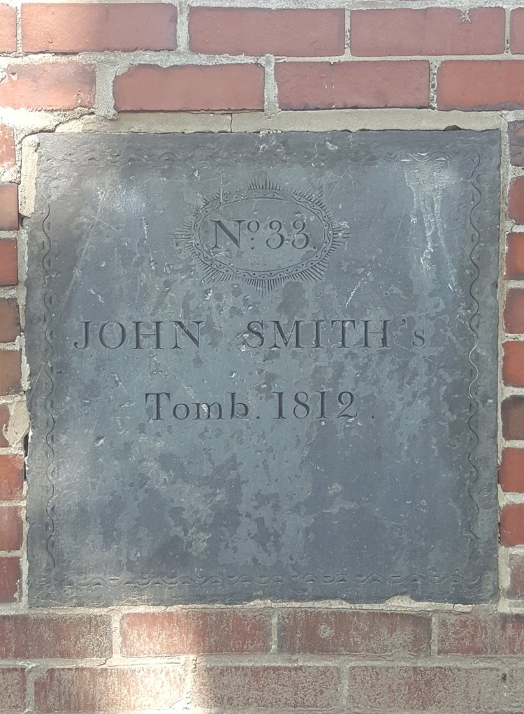
A note from our founder: I want to bring special attention to one fascinating tomb plaque on the northern edge of this section. I've been playing video games all my life, and if they have taught me anything, it's that a plaque located in a peaceful, forgotten part of an old burying ground, bearing the name "John Smith," in surprisingly pristine conditions after 200 years, is suspicious at best. I believe this location activates a quest, but I have not yet figured out how to proceed in the main story line to unlock this for my character.
Go back up the steps and turn right. Follow the path around to the left and continue straight across the cemetery to the western edge.
Copp's Hill - African American Area
A small community of free African Americans lived on the steep slope of Copp's Hill from the 17th to the 19th century. More than 1,000 of them may be buried in Copp's Hill Burying Ground, primarily in the northwest corner, in the area along Snow Hill Street that has fewer surviving gravestones. The lack of stones may be because the stones were removed or lost, or the memorials were made of wood that has since decayed. The local free African American community started about 1650, when a small number of slaves gained their freedom.
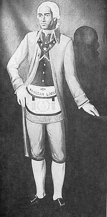
Prince Hall (c. 1735-1807)
One of the more notable people buried in this area is Prince Hall, who "was one of the most influential free Black leaders in the late 1700s," and was sometimes referred to as the "forgotten founding father."
After being freed from slavery at the age of 35, he assumed a leadership role in the African American community. He left a legacy of activism and fighting for equality:
- Drafting petitions for the abolition of slavery
- Protesting the slave trade and objecting to the exclusion of African American children from schools
- Actively speaking out against the kidnapping of free Black men from Boston
- Founding the African Lodge of the Honorable Society of Free and Accepted Masons of Boston, the first lodge of black Freemasonry
When he died, it appears that he was buried near his first wife, Sarah Ritchie, as his name is inscribed on the back of her grave marker (D-16).
Loop around the burying ground if you wish - note that you will get a better view of the harbor in a few stops! Head to the center/top of the burying ground, where there is a large squarish stone patio.
Copp's Hill - Scenic Spot
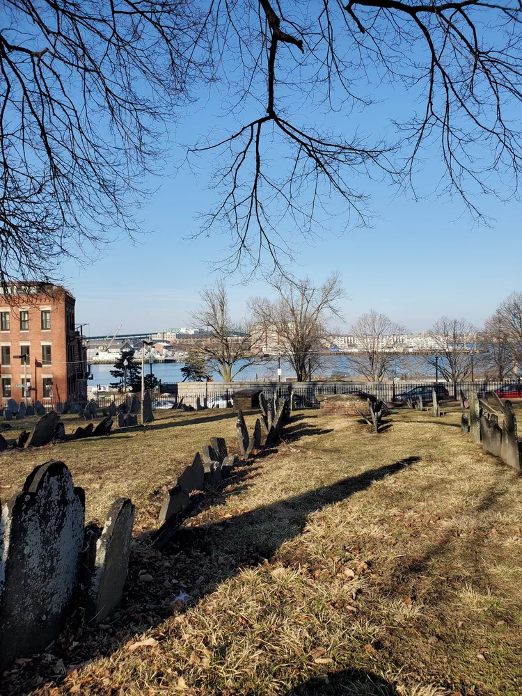
This spot is simply a good location to take in the neighborhood and view around you. The view toward Charlestown and the water is spectacular, especially in the colder months when the lack of tree leaves allows for unobstructed views.
Exit the burying ground via the same stairs you entered. Turn right on Hull St, then an immediate right again on Snow Hill St. About halfway down the street is a one-story house on a sharp corner.
North End's Tiniest Home
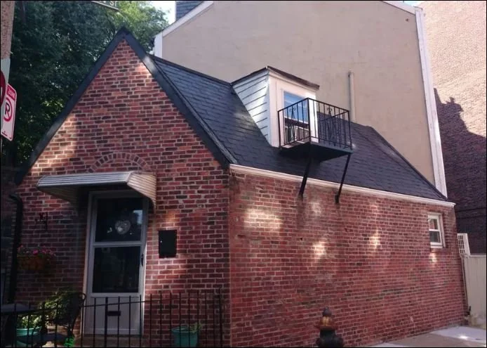
Like the Spite House, please note that this is an active home, not a museum, so please be polite and refrain from peering in the windows.
The 500-square-foot (46 square meters) house at 54 Snow Hill Street is the North End's tiniest standalone single-family home. It's also one of the 10 tiniest houses in Boston.
Despite its tiny size, the house packs a lot of stuff! Inside includes a loft bedroom, a full kitchen, full bathroom, full living room, and even a fireplace! Outside has a small patio, and, of course, very quiet neighbors across the street.
Continue down Snow Hill Street, then take a right on Charter St. at the end. Walk up your second big uphill, and on your left, you will see Copp's Hill Terrace. Enter the terrace and gaze at the harbor. If you have a snack, the picnic benches here are a great place to pause!
Copp's Hill Terrace
Take a short break in this cool shaded urban retreat while you take in views of Charlestown, Bunker Hill Monument, and the marina across the bay.
By the 1890s, the North End was one of the most densely inhabited urban districts in the United States, packed with tenement buildings and many shops. Through the urging of councilman (and future mayor) John "Honey Fitz" Fitzgerald, Copp's Hill Terrace was built as the largest open space in this teeming district.
However, the architect in charge of the job was not as elated as residents. After designing the terrace, Charles Eliot wrote in sadness to his wife in 1895 that Copp's Hill Terrace provided a recreation retreat for "the slum people . . . unclean beings, children pushing everywhere and swarming in every street and alley".
A few decades later, a large crowd observed the destruction wrought by Boston's Great Molasses Flood of 1919 from the safety of this very terrace.
Head back out of the Terrace the way you came and head down Snow Hill St. Cross Commercial St and turn right. Walk past the baseball field (don't miss the sign commemorating the Great Molasses Flood!), then past the bocce courts, then turn left and walk between the Bocce Courts and the multipurpose athletic field. At the end of your path, the material under your feet turns from concrete to wood and, next to the basketball court, there is a small part that juts into the water.
Langone Park & USS Constitution
This multi-named park (Puopolo Playground, Langone Park, and Puopolo Athletic Field are various parts of it) is a favorite neighborhood hangout spot with bocce, basketball, baseball, a public pool, and chess tables.
This stop offers a great skyline view that includes the Zakim bridge, Bunker Hill Memorial, the USS Constitution, and parts of East Boston.
USS Constitution ("Old Ironsides")
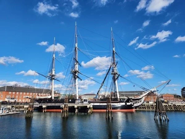
The USS Constitution is the world's oldest ship still afloat, having launched in 1797. It is technically still a commissioned ship of the US Navy, and her crew are all active-duty service members, but today she is mostly used as a museum and heritage site. Every day at sunset, the crew fires a salute cannon which can be heard from this park.
Climate-Resilient Design
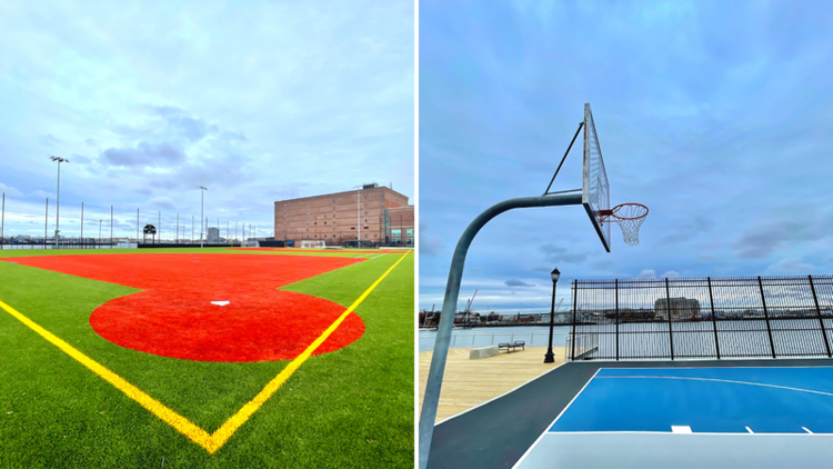
Langone Park is the first park in Boston to integrate the standards set forth by the City of Boston's Climate Resilient Design Standards. The design incorporates structural elements to elevate the park up to seven feet without affecting adjacent structures.
"The Secret" - Boston's Buried Treasure

Note the red symbol on the map with the chest icon located at the home plate of the baseball field. There is no visible marker in real life, but this marks the location of Boston's real buried treasure!
A local family made this incredible find after solving a puzzle from a 1982 book called "The Secret". The hunt involves a search for twelve treasure boxes across the United States and Canada. As of October 2019, only three of the twelve boxes have been found.
Head back between the bocce courts and athletic field to Commercial St, then take a left and walk along the athletic field. Cross Commercial St and continue another block and a half to Greenough Lane. Don't miss it! It's very narrow and looks more like a back alley than a street.
Charter St Park / Greenough Lane
Proceed down the half-paved, half-cobblestone alley to reach Charter Street Park, one of Boston's best urban parks tucked away in a quiet part of the North End.
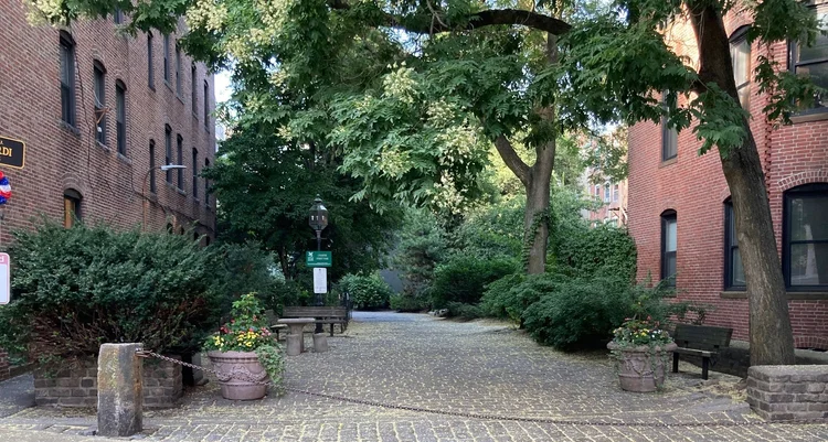
This quiet park is a great spot to enjoy a cup of coffee and take a breather. The flowers are planted by local school children from the Eliot School across the street. Look out for the lower level gardens around the park.
Can you spot the balconies with no windows or doors?
Continue through the park and take a left on Charter St. Turn left again on Hanover St, then cross to Battery St. The next stop is on the left side of Battery St.
All Saints Way
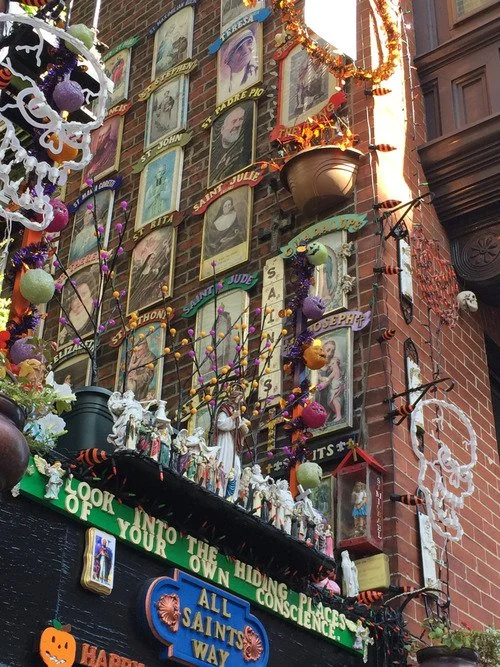
Nestled in the North End of Boston, this alley is called All Saints Way. Behind an iron gate you can see the Wall of Saints: portraits ascending up the exterior brick wall of the adjoining building.
This private collection has grown into a street-side shrine, with a display of the canonized including photos, statues, prayer cards, and tribute to Roman Catholic saints.
While the shrine is a personal project on private property, the owner, Peter Baldassari, was known to give quick tours before he passed in 2025. A group of volunteers now maintains it, and if you get lucky, one may let you in! A good portion of the collection is visible from the street, even if the gate is locked.
Proceed along Battery St. Cross Commercial St and head down Battery Wharf (keep Cafe Amalfi on your right). Follow the building around to your left and you'll see the Battery Wharf Coast Guard Museum.
Battery Wharf Coast Guard Museum
This free pocket museum documents Battery Wharf's maritime history. In 1646, a shoreline battery was built here to protect the mouth of the Charles River and cover Boston Harbor. On June 17, 1775, more than half the British soldiers who attacked Breed's Hill departed from this wharf.
Exhibits cover shipbuilding, waterfront industry, and the "Birthplace of the Coast Guard." The museum floor was milled from the original live-oak pilings that once supported the wharf. An observation deck on the second floor offers views of Boston Harbor and the active Coast Guard station next door.
Free admission • Open daily until 9pm
Water Taxi
Outside the Museum is a waiting area for the water taxi stop. A unique (although somewhat pricey) way to get around Boston, Boston Water Taxis stop at nearly 20 points around Boston Harbor. It is not a regularly-scheduled service; you must pre-book to be picked up.
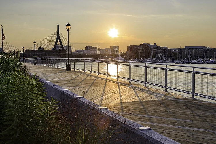
Continue along the pier that juts into the Harbor. This is part of Boston's famed Harborwalk, which stretches more than 40 miles from the northern end in Charlestown to the southern end in Neponset.
Harborwalk
There are numerous wharves along the Harborwalk sticking out into the harbor, all with amazing views. There is nothing in particular to point out at the exact location of this stop; the entirety of the Harborwalk from the prior stop to the next stop is worth walking and viewing.
Make your way down to Columbus Park following our recommended route along the Harborwalk, or the quicker direct route via Commercial Street.
Follow the Harborwalk south toward Columbus Park, or take Commercial Street for a quicker route.
Rose Kennedy Rose Garden
This secluded space honors America's Gold Star Mothers as well as Rose Fitzgerald Kennedy, mother of President John Fitzgerald Kennedy.
American Gold Star Mothers is a veterans' service organization that provides support for mothers whose child was lost in the line of duty while serving in any branch of the US Military.
Mrs. Kennedy became a Gold Star Mother on August 12, 1944, the day her oldest son, Joseph Patrick Kennedy Jr. was lost in action when his airplane exploded over the English Channel.
Continue through the park to the intersection of the crossing paths, in between the two famous Columbus Park Trellises.
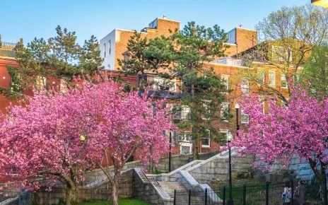
Columbus Park
A beautiful spot for pictures any time of day or year. During the summer, the path under the trellis is often lined with potted flowers and other seasonal decorations. The lawn will often be packed with tourists and locals alike enjoying the sun and the view.
In the winter, the park is decorated and the trellis lit for the holidays.
Stop to take a picture, or watch the planes take off from the airport across the harbor!
Continue in the same direction, towards the Marriott Long Wharf (long brick building). Follow the brick and wood paths along the harbor to the end of Long Wharf.
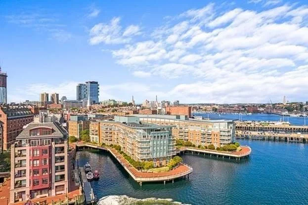
Long Wharf

When originally built, the shoreline was near Faneuil Hall, and the wharf extended more than a third of a mile into the Harbor. This length thrust it considerably farther than other wharves into deep water and thus allowing larger ships to tie up and unload directly to new warehouses and stores, instead of using tender boats to get their goods ashore.
Constructed by Captain Oliver Noyes, it was lined with warehouses and served as the central focus of Boston's great harbor. Today the wharf building is occupied by a hotel, several restaurants and shops. At the seaward end, there is a large plaza with extensive views of the harbor.
Climate Change Impacts
Due to recent climate change related flooding, Boston has been experiencing unusually high water in low lying areas of the city. The Long Wharf area has recently made headlines for the very noticeable levels of flooding in the area. Local news has reported "wicked high tides," with floodwaters covering the Wharf up to a meter deep during bad weather and making it almost entirely inaccessible.
Head back along the opposite side of Long Wharf towards the city. Take a left around the ticket booth at the end of the wharf and walk towards the parking garage. Cross the street into the small park, called Central Wharf Plaza.
Central Wharf Plaza
Here your tour ends! There are a few places to go from here:
- New England Aquarium - The geometric buildings on the water are the New England Aquarium and its adjacent IMAX theater. Go see the seals outside the Aquarium for free, or buy tickets to see the penguins, the giant 200,000 gallon Central Ocean Tank, and much more inside!
- Faneuil Hall Marketplace - Just 3 blocks to your Northwest, across Atlantic Ave, is the famed Faneuil Hall Marketplace, with loads of shops and food.
- Continue on the Greenway or Harborwalk - Both options are beautiful ways to continue southbound. If you need food, both will take you the half-mile to the world-famous James Hook Lobster Co for a lobster roll or chowder!
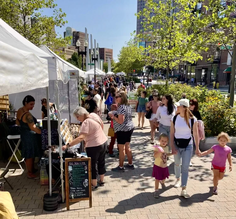
- Greenway Artisan Market - On Saturdays from May 1 through October 31, this stretch of the Greenway hosts the local artisan market. Stay and browse!
You've completed the North End Self-Guided Tour! Explore nearby areas or check out our neighborhood guides for more adventures.
Tour Complete!
Congratulations! You've completed the North End Self-Guided Tour and explored one of Boston's most historic and charming neighborhoods.
We hope you enjoyed discovering the hidden gems of the North End, from Revolutionary War history to modern treasures.
Want to Learn More?
Check out our North End Neighborhood Guide for food, shopping, and more recommendations!
More Self-Guided Tours
Enjoyed this tour? Check out our other free self-guided walking tours in Boston!
Frequently Asked Questions
How long does the North End Self-Guided Tour take?
The tour takes approximately 2 hours to complete, covering 3.4 miles (5.5 km). You can take longer if you want to explore specific stops in more detail, grab a meal, or visit museums along the way.
Is the North End Self-Guided Tour free?
Yes, the self-guided tour is completely free! The only optional costs are $5-10 for entry to various sites like the Old North Church if you wish to go inside. The tour content, map, and all outdoor attractions are free to access.
What are the main highlights of the North End Self-Guided Tour?
The tour includes 22 stops featuring Paul Revere's House, the Old North Church (famous for the "one if by land, two if by sea" lanterns), Copp's Hill Burying Ground, the Skinny House, All Saints Way, the Battery Wharf Coast Guard Museum, harbor views of the USS Constitution, and hidden gems like Greenough Lane and Charter Street Park.
Is the tour suitable for children?
Yes! The tour is family-friendly with interesting stories, hidden treasures to discover, and plenty of parks along the way. The route is mostly flat with a few hills near Copp's Hill. Consider breaking it into sections for younger children.
Can I do the tour in any order?
While the tour is designed to follow a logical path through the North End starting and ending near the Rose Kennedy Greenway, you can certainly visit stops in any order that works for you. The numbered stops on the map help you navigate regardless of your starting point.